|
Rancocas Nature Center's
Beginner Navigation Courses Designed in 2023 by Aaron Sperry from BSA Scout Troop 4024 in Beverly, NJ for his Eagle Scout Project. To benefit Scouts and the General Community. To learn Introductory Skills required for Orienteering.
Orienteering is a sport that utilizes highly detailed topographical maps to test a person or team’s skills to navigate courses in a competition setting.
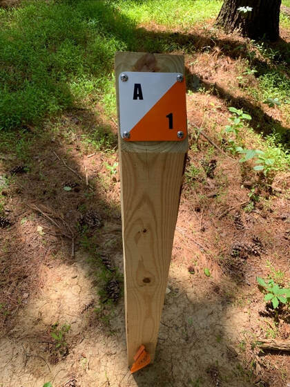
At present, the Rancocas Nature Center does not have the highly detailed map required to be an official permanent orienteering course (it’s on our wish list!). However, the 20 permanent markers placed throughout our nature preserve are in the style of official orienteering markers and the courses available here can be used by scouts or other groups to make their own “competition” or just practice their Navigation skills of estimating distance, compass use, and orienting yourself utilizing a map and compass. The courses range in distance from about 300m to 1609m (1 mile). Determining your pace length
(the distance of your stride) A marked 100 meter pre-measured distance is available at the beginning of the Eastern section of Blue boardwalk trail starting at the trail maker junction with the yellow green trail just south of the large trail map.
A single pace is 2 steps. To determine your pace length, walk in a natural stride from the 0 meter marker to the 100 meter marker. Then divide 100m by that number to get the length of your pace. It is strongly recommended to do this 3 times and take the average to get the best estimate of your pace length. |
Simple Map Courses
click links to view maps |
Compass Only Courses
|
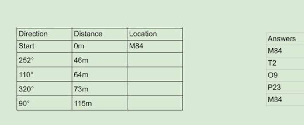
298m 4-Point Compass Course
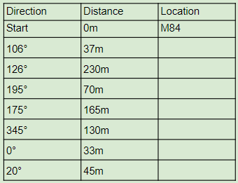
710m 7-Point Compass Course
|
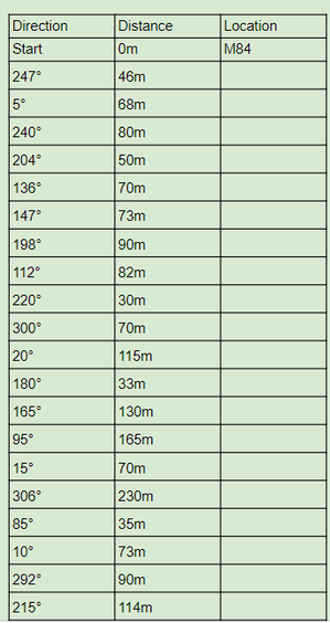
1714m 20-Point Compass Course
|


